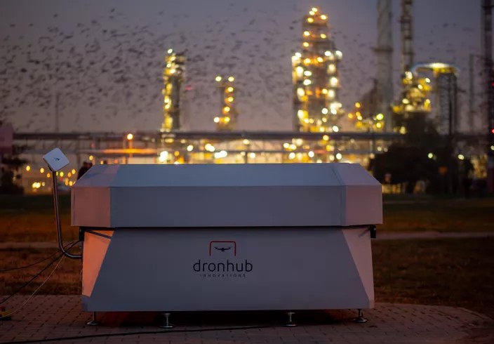
PKN ORLEN, the biggest oil refinery in Eastern Europe using drones to extend oil and gas industry.
PKN Orlen refinery is a critical infrastructure and thus requires a premium level of security. The company is a leading player in the fuels and energy markets, and the largest company in Central and Eastern Europe. The ORLEN Group operates in 6 home markets – Poland, the Czech Republic, Germany, Lithuania, Slovakia, and Canada.
PKN Orlen was seeking the solution for the effective monitoring of its critical infrastructure. Our autonomous drones helped to monitor the condition of infrastructures to reduce the possibility of potential industrial discrepancies. In case of an unexpected crisis such as fires or gas leaks, the drones ensured team safety by substituting them, while offering an aerial vantage point to the coordinators of the operation.
As a surveillance tool, Dronhub’s specific tasks was to monitor refinery facilities to strengthen site surveillance, particularly the restricted zone. During a series of flights, the UAV was successful in using high-resolution camera technology to specifically investigate and identify any danger and collect important data to analyze.
The drone was sent on pre-recorded flight missions manually or automatically. During the flights,
the operator monitored the drone’s camera just like any other PTZ camera. When the mission was finished, the drone returned automatically to its docking station to be recharged.
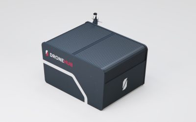
The Oil Refinery must be secured seven days a week and 24 hours a day. It became clear that human presence should be complemented by drone technology. The drone fleet, integrated with the Dronhub docking station, improves the responsiveness and efficiency of the security teams that monitor the refinery.
PROBLEM DEFINITION
Traditional techniques for monitoring are often expensive, inefficient or impractical, especially in remote and rough terrain. UAVs have the potential to both improve and automate data collection for monitoring and help in making decisions.
Another point is fixed cameras which are limited in what they can view, even Point to Zoom (PTZ) cameras have their limitations and capabilities. There is a great need for maintenance data, but the costs are high. Most application areas demand not one but multiple data collection.
Dronhub overcomes these barriers and it is capable of carrying out surveillance missions in a completely autonomous way.
The UAVs are equipped with optical and thermal cameras; they operate day and night to perform specific checks, conduct perimeter patrols, or monitor interventions at a distance.
UAVs can fly continuously over long distances and for long periods, which it stores on batteries to keep operating at night. Dronhub is completely independent: it does not require any fossil fuels and does not need to be controlled on-site.
This complete autonomy system allows you to develop your monitoring and data collection activities.
TECHNOLOGY USED
Imaging data is spread through a data networking, and the computer is used to store and prepare images for transmission while recording data such as camera settings, altitude, and position that are attached to images and metadata.
The data is sent to the UAV Dronhub ground station via a wireless network capable of achieving real-time wireless data retrieval of long miles.
UAVs are capable of capturing large format images and metadata. The data is stored on the cloud-based platform.
Flightpath and other mission requirements are set by ground station engineers into the mission planning software that equipped the autopilot with the data necessary to direct and control the aircraft during the mission.
Multiple cameras are used to acquire images, where typically one vertical and multiple oblique cameras are used simultaneously. The images captured by these systems allow for the three-dimensional reconstruction of a scene.
The level of detail and picture accuracy from this multi-camera approach exceeds what would be possible from a single camera when combined with a wide-angle lens.
SURVEILLANCE TOOLS:
High power zoom lenses: collect real-time video and image capture from a distance that is imperceptible to the object or target being surveilled
Night vision, infrared, ultraviolet, and LIDAR (Light detection and ranging)
Radar technologies
Video analytics technologies
Could based data storage
Web application & drone (VPN, GSM, GPS Tracking)
Mission planning and control (roadmap)
Encrypted communication system
Modular data storage and processing system
Modular design that can be adjusted to any infrastructure and IT systems
Monitoring of drone and docking station parameters and telemetry data (cameras, thermal vision, sensors)
Real-time monitoring and mission management (flight parameters and direction)
TECHNICAL DETAILS
Drone
Number of engines: 6
Maximum take-off weight: 7 kg
Maximum flight time: 42 min
Maximum load weight: 1 kg
Maximum range: 30 km
Maximum speed: 60km/h
Unfolded dimensions: 70 x 70 x 40 cm
Folded dimensions: 50 x 30 x 20 cm
Sensors: Thermovision (optional), HD camera,
Power: Electrical power
Battery: LI-PO 22 000 mah 6s
Docking station
Measurement: 2100 x 2100 x 115 mm
Weight: 400 kg
Power supply: 230V,50hz
Rated power: 3kW
Communication: Ethernet (RJ-45)
Working area: 2100 x 4300 mm


