Key facts
Major commercial ports run perimeter lengths of 5 to 50+ kilometres depending on facility scale, across land, quayside, and water boundaries. Manual perimeter inspection at this scale is calendar-impossible without continuous overflight.
Source · Comparative port-facility perimeter analysis
Container-terminal infrastructure (gantry cranes, quay cranes, RTG cranes) requires periodic structural inspection at altitudes 30 to 90 metres above grade — risky for manual climb teams and slow for boom-lift operations. Drone inspection cuts cycle time by an order of magnitude and removes the personnel-at-altitude exposure.
Source · Port-infrastructure inspection benchmarking; comparative operations data
Port-targeted hostile UAS use cases include drone-borne smuggling (contraband to container yards or moored vessels), surveillance (mapping of port operations for criminal-organisation or state-level intelligence), and direct disruption (drone-deployed device targeting vessels or infrastructure).
Source · Maritime security threat analysis 2022–2025
3 more key facts
Port operations are critical-infrastructure designation under EU NIS2 and US CISA frameworks — sovereign supply-chain restrictions on UAS procurement apply directly to port operators in regulated jurisdictions.
Source · EU NIS2 Directive; US CISA critical-infrastructure designation framework
The same Dronehub drone-in-a-box platform that runs Deutsche Bahn rail inspection runs perimeter, condition, and counter-UAS missions at a port — only the per-asset taxonomy in Sentinel changes per deployment, not the underlying platform architecture.
Source · Sentinel per-asset taxonomy architecture; Dronehub product portfolio integration
Net-capture counter-UAS at a port can be paired with maritime-patrol drones for above-water threat detection and intact-recovery onto port quayside — the AUDROS engagement profile adapts to the maritime environment without architectural changes.
Source · AUDROS counter-UAS programme architecture; port-deployment adaptation
In this piece
A major commercial port has three drone-driven operational needs that the conventional procurement frame treats as separate problems: perimeter security, asset-condition monitoring, and counter-UAS response. One drone-in-a-box infrastructure handles all three. That convergence is the procurement argument for port operators evaluating the technology — not "buy three platforms" but "buy one platform that does three things." This post walks through the operational profiles, why a single architecture covers them, and what the deployment looks like at scale.
Ports are critical infrastructure. They're under tighter regulatory scrutiny under EU NIS2 and US CISA frameworks. They face threats that have been growing across the 2022-2025 window. And they have asset-management workflows whose costs and risk profiles drone-driven operations can materially improve. This post is the procurement-grade brief.
The port operational profile
Commercial ports are large, complex, dual-environment (land plus water) facilities with high-throughput operations, multiple stakeholder relationships, and significant exposure to security and safety incidents.
A mid-sized regional port handles between 100,000 and 1 million TEU (twenty-foot equivalent units) annually, with a land-side footprint of 50-200 hectares, 5-15 km of total perimeter, 4-12 gantry cranes serving 2-6 container berths, plus quay-wall infrastructure, container yards, rail-link connections, warehousing, hazmat handling, and fuel infrastructure. A major international port (Rotterdam, Hamburg, Antwerp, LA/Long Beach, Singapore, Shanghai-class) operates at 5-10× that scale.
Three operational characteristics drive the drone-procurement decision.
Persistent surveillance requirement. The port's perimeter doesn't sleep. Vessels arrive and depart on tidal schedules and operational windows. Container traffic moves 24/7. Security exposure is continuous. Fixed cameras handle some of the coverage but leave gaps; mobile foot patrols handle some but at significant labour cost; drone-driven persistent overhead surveillance closes the remaining gap.
Asset-condition complexity. The port's physical assets — cranes, quay walls, container handling equipment, fuel infrastructure — require periodic inspection that's expensive in personnel-at-altitude exposure and operationally disruptive. Drone inspection collapses cycle time and removes personnel risk.
Regulatory designation. Ports operate under critical-infrastructure designation in most jurisdictions. The procurement frame inherits sovereign-supply-chain restrictions, data-sovereignty rules, and audit requirements that constrain vendor selection.
The drone-in-a-box infrastructure that fits this profile is one that serves multiple mission types on one platform, satisfies the sovereign supply-chain frame, and integrates with the port's existing operational and security workflows.
Use case one: perimeter security
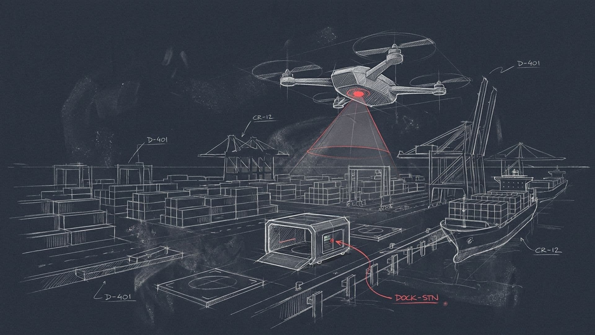
The perimeter-security mission is the highest-volume use case across most port deployments. The drone-in-a-box dock(s) run continuous overflight patterns along the perimeter, with edge-AI classifiers on-board identifying anomalies (unusual movement, unauthorised access, vessel-anchorage violations, suspicious patterns) and the cloud-side taxonomy categorising and prioritising for the port-security operations centre.
The deployment-pattern logic:
- Dock density scales with perimeter length. A 5-15 km perimeter typically deploys 2-4 docks placed for overlapping coverage. A 30-50 km perimeter scales accordingly. Dock placement balances coverage geometry against the operational-cost-of-flight (longer transit-to-perimeter from a dock increases per-mission overhead).
- Mission cadence depends on threat profile. Routine continuous patrol typically runs 20-25 missions per day per dock (the platform's structural capacity with robotic battery swap). High-threat scenarios run double-cover with the dock servicing two UAVs in rotation.
- Sensor payload is mission-tunable. EO/IR for daylight surveillance, thermal for night and low-light, RF sensing for hostile-UAS detection where the perimeter scope includes air-side threat. Mission profile determines payload.
- Operator integration sends detections into the port-security command stack — typically VMS (video-management system) plus PSIM (physical-security information management) integrations with the port's existing Genetec, Milestone, or vendor-specific platforms.
The perimeter-security mission is what most ports start with when procuring drone-in-a-box capability. It's the highest immediate-value use case, the easiest to model into a procurement business case, and the cleanest integration into existing security operations.
Use case two: asset-condition monitoring
The asset-condition mission addresses the inspection workload that ports run on cranes, quay walls, vessels at berth, container handling equipment, and other physical assets that require periodic structural and condition assessment.
The classical inspection approach has costs:
- Manual climb inspection of cranes (gantry, quay, RTG) takes 4-8 hours per crane and exposes personnel to altitude risk. A port with 8 cranes running annual inspections is committing 40-60 hours of personnel-at-altitude per year before any condition-driven follow-up inspections.
- Boom-lift inspection is faster but requires asset shutdown and operational disruption during the inspection window. Container traffic loss during a multi-hour crane shutdown is meaningful.
- Visual-only inspection from ground level misses defects above sight-line and has poor coverage of crane-girder, jib-condition, and structural-detail areas.
Drone inspection compresses cycle time and removes personnel-at-altitude exposure. A drone-based inspection of a gantry crane runs 20-30 minutes (versus 4-8 hours manual), with no asset shutdown, with personnel safely at ground level reviewing the captured imagery, and with the Sentinel per-asset taxonomy classifying defects (corrosion, weld condition, structural anomalies, paint condition) and severity-scoring for the operator's maintenance planner.
The mission profile uses the same drone, same dock, same edge-AI pipeline as the perimeter-security mission. The per-asset taxonomy changes — instead of intrusion-detection taxonomy, the cloud-side detector runs the crane-asset taxonomy. The operator handoff sends the detections into the port's CMMS (Maximo, SAP PM, vendor-specific maintenance-planning) rather than into the security VMS.
Use case three: counter-UAS
The counter-UAS mission addresses the port-targeted hostile-UAS threat profile. Three primary categories of threat:
Smuggling. Drone-borne contraband delivery into container yards or onto moored vessels. The threat profile has matured from rare anomaly to operational concern across major commercial ports — drugs, weapons, currency, electronics smuggling via drone delivery exploits the port's open overhead envelope. The contraband-detection and intact-recovery properties of net-capture counter-UAS apply directly.
Surveillance. Adversary mapping of port operations — vessel arrival schedules, container layout, security positions, infrastructure design. The intelligence collected may be criminal-organisation (planning cargo theft, smuggling-route optimisation) or state-level (sanctions evasion, strategic-asset tracking). Hostile-UAS detection and tracking, even without engagement, supports the port's counter-intelligence posture.
Disruption. Drone-deployed devices targeting vessels, fuel infrastructure, crane operations, or command facilities. Lower frequency than smuggling or surveillance, higher consequence-of-event. The CBRN response variant of AUDROS applies to ports handling hazardous-chemical or radiological cargo where the consequence-of-event drives the procurement decision.
The counter-UAS deployment uses the same dock infrastructure as the perimeter-security and asset-condition missions. The Eagle One net-capture interceptor stages from the same dock that runs ISR missions. The detection layer (radar, RF sensing, machine-vision) integrates with the same operator command stack. The engagement-response cycle adds counter-UAS to the port's existing security envelope without requiring separate infrastructure.
For ports operating in maritime-environment c-UAS scenarios, the engagement profile adapts — the interceptor stages from the port quayside, engages over water if necessary, and recovers the captured target onto port-side recovery point. The maritime adaptation of AUDROS doesn't require architectural changes; the engagement geometry adjusts to the operating environment.
Why one platform covers all three
The architectural property that makes the multi-mission deployment economically viable is the shared substrate.
Hardware. Same drone airframe, same dock, same battery infrastructure. The mission tunes via payload (sensor configuration) and software (per-mission autonomy stack). One spare-parts inventory; one maintenance pipeline; one operator-training curriculum.
Edge AI. Same Nvidia Jetson on-board compute. The per-mission classifier deploys to the edge as a software artefact. Switching from perimeter-security mode to asset-condition mode to counter-UAS mode is a software configuration, not a hardware change.
Cloud architecture. Same Sentinel cloud-side processing. The per-asset taxonomies (intrusion-detection, crane-defect classification, hostile-UAS identification) live in the cloud-side detector federation. The same compute infrastructure handles all three mission classes.
Operator integration. Same operator-handoff layer. The data routes into different downstream systems depending on the mission class (VMS/PSIM for security, CMMS for asset condition, security command stack for c-UAS), but the integration layer is unified rather than per-mission-specific.
The combined effect: a port operator buying multi-mission drone-in-a-box capability buys one infrastructure deployment instead of three. The TCO is materially lower than three single-purpose systems. The operational complexity is lower. The maintenance pipeline is simpler. The training requirement for operators is lower.
Procurement pathways
For commercial port operators in regulated jurisdictions — direct industrial licensing through Dronehub Sp. z o.o. (EU operators under EDIS-aligned procurement) or Dronehub Inc. (US and allied operators with Section 848-compatible documentation). The licensing engagement is structured around the multi-mission deployment, with the port operator licensing the full Sentinel capability stack plus the manufactured drone-in-a-box hardware.
For ports under national-government control or with state-level security designations — through the relevant national procurement channel, typically with Dronehub serving as either prime contractor or sub-contractor to the national defense industrial partner. For US ports under DHS / Coast Guard / state-level critical-infrastructure programmes — direct SBIR/STTR pathways exist for the counter-UAS and AI-inspection components.
For port operators with NDAA Section 848 exposure (federal-civil-adjacent operations, defense-supply-chain participation, military-port operations) — the Section 848-equivalent documentation and the NATO-allied non-CN supply chain pre-resolve the diligence pack.
For port operators in the broader EU EDIS frame — the EDIS-aligned manufacturing at Jasionka, the Polish Sp. z o.o. entity structure, and the EU + US data-sovereignty architecture satisfy the procurement frame on first cycle.
The drone-in-a-box product page is at /drone-in-a-box. The Sentinel architecture deep-dive is at /blog/halo-cloud-architecture-deep-dive. The battery-swap mechanism that enables persistent operations is at /blog/robotic-battery-swap-vs-in-station-charging. The critical-infrastructure context is at /industries/critical-infrastructure. For a port-deployment conversation, open the contact form.
FAQ
- What's the perimeter security envelope at a port?
- Larger and more complex than most operators initially scope. A commercial container port has a land-side perimeter (fencing, gate operations, container yards, rail-link connections, warehousing), a quayside perimeter (vessels at berth, crane operations, fuel handling, hazmat storage), and a water-side perimeter (anchorage zones, approach channels, vessel-traffic separation). The combined perimeter length runs 5-15 km at a mid-sized regional port and 30-50+ km at a major international port. Fixed-camera coverage handles part of the surface; the gap is mobile, persistent, three-dimensional overwatch — which is the drone-in-a-box envelope. A perimeter-class deployment runs 20-25 missions per day per dock, with sufficient dock density to maintain continuous overhead coverage.
- How does drone inspection compare to traditional crane and quay inspection?
- Cycle time collapses by roughly an order of magnitude. A gantry crane inspection by manual climb or boom-lift takes 4-8 hours and exposes personnel to altitude risk. A drone-based inspection of the same crane completes in 20-30 minutes with no personnel at altitude. The quality of the inspection improves — the drone captures complete coverage of the asset including angles that manual inspection misses, with each frame timestamped and GPS-pinned for the operator's audit chain. The cost compresses both on direct labour and on operational disruption — drone inspection runs alongside ongoing operations rather than requiring asset shutdown. Manual inspection retains a role for the close-tactile work that drones can't replace (bolt-torque verification, internal-cabin condition, specialised mechanical assessment); the drone covers the visual-survey and structural-defect portion that constitutes most of the inspection volume.
- What's the port-targeted UAS threat profile?
- Three primary categories. (1) Smuggling — drone-borne contraband (narcotics, weapons, currency, electronics) delivered into container yards or onto moored vessels, exploiting the port's open overhead envelope. The volume is meaningful and growing across major commercial ports globally. (2) Surveillance — adversary mapping of port operations, vessel schedules, security postures, and infrastructure layouts. The intelligence collected may be criminal-organisation (cargo-theft planning) or state-level (sanctions evasion, strategic-asset tracking, counter-shipping intelligence). (3) Disruption — drone-deployed devices targeting vessels, fuel infrastructure, container handling, or port command facilities. Lower frequency than the first two but higher consequence-of-event.
- Does one drone-in-a-box platform really cover all three use cases?
- Yes, because the underlying architecture (mobile platform with persistent overhead operations, edge-AI classifier on Jetson, cloud-side per-asset taxonomy, operator handoff to existing port-management workflow) is shared across all three. The differences are in the mission profile (perimeter pattern vs asset survey vs threat response) and the AI taxonomy (intrusion detection vs crane-defect classification vs hostile-UAS identification). The same drone hardware can fly any of the three mission types; the dock supports them all from the same infrastructure; the data path routes through the same sovereign cloud layer. For an operator, the economics of a multi-mission deployment are substantially better than running three single-purpose systems.
- What's the data-sovereignty story for international port operators?
- Port operations data is sensitive — vessel manifests, container locations, schedule data, security postures, infrastructure layouts. International port operators frequently handle data subject to multiple jurisdictions simultaneously (port location, vessel flags, cargo origin/destination, operating consortium home jurisdiction). EU NIS2 and US CISA critical-infrastructure frameworks impose sovereign-data-path requirements directly. Sentinel runs on EU and US sovereign infrastructure by architecture, with regional segmentation supported per deployment. For ports operating under additional national security frameworks, dedicated-tenant or air-gapped deployment options are available.
- What's the procurement pathway?
- For commercial port operators in regulated jurisdictions — direct industrial licensing through Dronehub Sp. z o.o. (EU operators) or Dronehub Inc. (US and allied operators). EDIS-aligned manufacturing for EU procurement; Section 848-compatible documentation for US federal-civil and homeland-security adjacent deployments. For port operators under national government control or with state-level security designations — through the relevant national procurement channel, typically with Dronehub serving as either prime or sub to the national defense industrial partner. For US ports under DHS / Coast Guard / state-level critical-infrastructure programmes — direct SBIR/STTR pathways exist for the c-UAS and AI-inspection components.