Key facts
US Track Safety Standards (49 CFR 213.233) require visual track inspections made on foot or from a vehicle — twice weekly on Class 4 and 5 track — and allow mechanical, electrical and other inspection devices only to supplement that visual inspection.
Source · eCFR, 49 CFR 213.233 Visual track inspections ecfr.gov ↗
The FAA's proposed Part 108 BVLOS rule (NPRM published 7 August 2025; no final rule published as of late September 2026) would define shielded areas as airspace within 50 feet of railroad tracks, power lines, substations, bridges and pipelines, when the infrastructure owner gives permission.
Source · Federal Register, 90 FR 38212, proposed § 108.205 federalregister.gov ↗
EASA's predefined risk assessment PDRA-G03 covers BVLOS 'linear inspections, agricultural works' with aircraft up to 3 m in size, over sparsely populated areas and close to obstacles, in controlled or uncontrolled airspace.
Source · EASA, Predefined risk assessment (PDRA) easa.europa.eu ↗
3 more key facts
EU standard scenario STS-02 allows BVLOS flights with a class C6 drone over a controlled ground area in a sparsely populated environment, up to 120 m high, with flight visibility above 5 km, no further than 1 km from the remote pilot without airspace observers or 2 km with them.
Source · EUR-Lex, Regulation (EU) 2019/947 (consolidated), UAS.STS-02.010 and .020 eur-lex.europa.eu ↗
ProRail, the Dutch rail infrastructure manager, states that open-category drone flights over the track are prohibited under national rules (minimum distance 25 m for drones under 4 kg, 150 m for 4–25 kg) and warns that 1,500–25,000 V overhead lines can disturb drones' radio signals and electronics.
Source · ProRail, Drones — practical information for suppliers prorail.nl ↗
The Association of American Railroads says freight railroads use drones with high-resolution cameras, LiDAR and thermal sensors to detect obstructions and debris, vegetation growth, structural degradation, drainage issues and erosion, and thermal anomalies in track.
Source · Association of American Railroads, How Freight Railroads Use Drones aar.org ↗
In this piece
A railway drone inspection programme is ready to fly when five things are settled: an aviation approval that matches how you will fly, the infrastructure manager's rules for working on or near the line, a sensor package matched to each asset, an operating model, and a data plan that gets findings into maintenance and respects privacy. In Europe the aviation side runs through Regulation (EU) 2019/947, and corridor work almost always lands in the "specific" category; in the United States it runs through Part 107 plus a waiver for beyond-visual-line-of-sight (BVLOS) flights, with the proposed Part 108 still pending. The checklist below covers each item, with the EU and US basis.
Disclosure: Dronehub builds drone-in-a-box infrastructure and an in-house AI inspection stack built for linear assets such as rail corridors. We have kept this checklist vendor-neutral and say so where our own product comes up.
The checklist at a glance
# | Item | What "done" looks like | EU basis | US basis |
|---|---|---|---|---|
1 | Flight category | Every mission type mapped to a category, approvals on file | Reg. (EU) 2019/947 — open, specific or certified | 14 CFR Part 107 |
2 | BVLOS approval | SORA-based authorisation, STS-02 declaration or PDRA-G03 | EASA AMC and GM to 2019/947 (SORA 2.5) | Waiver of § 107.31 under § 107.205; proposed Part 108 |
3 | Track access | Written agreement with the infrastructure manager; flight-notification procedure | Infrastructure manager's rules | Railroad operating rules; roadway worker protection, 49 CFR 214 Subpart C |
4 | Electrical safety | Agreed standoff from live overhead lines; isolation arranged for close work | Infrastructure manager's rules | Railroad electrical-safety rules |
5 | Sensors per asset | Each defect class mapped to an RGB, LiDAR or thermal specification | — | — |
6 | Navigation integrity | Compass and GNSS behaviour tested near overhead lines, bridges and cuttings | Operations manual | Operations manual |
7 | Operating model | Crew, remote operations centre or docks, with response times defined | — | — |
8 | Emergency procedures | Lost link, forced landing near the track, who calls the signaller | Operations manual | Waiver conditions |
9 | Privacy | DPIA done before flights; blurring and retention rules | GDPR Article 35 | State drone and privacy laws |
10 | Data integration | Findings tied to track position and asset ID, flowing into maintenance | — | — |
11 | Model validation | Precision and recall measured on your own network's data before go-live | — | — |
12 | Records | Flight logs, aircraft maintenance, pilot currency, audit trail of findings | UAS.SPEC.050 — records kept at least 3 years | Waiver conditions, internal QA |
Regulatory basis in Europe
Open, specific or certified
Regulation (EU) 2019/947 sorts every drone operation into the open, specific or certified category. The open category needs no authorisation but requires visual line of sight, a height of 120 m or less and an aircraft under 25 kg; the specific category requires an operational authorisation from the national aviation authority, or a declaration against a standard scenario.
Railway inspection almost always ends up in the specific category: useful corridor work happens beyond visual line of sight, and national rules keep open-category drones off the track. ProRail, the Dutch infrastructure manager, states that open-category flights over the track are prohibited under national rules, with minimum distances of 25 m (drones under 4 kg) or 150 m (4–25 kg); specific-category flights over the track are allowed under conditions and must be reported to its rail control room.
SORA 2.5, STS-02 and PDRA-G03
A specific-category application rests on a SORA risk assessment; EASA brought in SORA 2.5 through ED Decision 2025/018/R, published on 29 September 2025. Two shortcuts reduce the work for linear assets:
- STS-02, a standard scenario you declare rather than apply for: BVLOS with a class C6 drone over a controlled ground area in a sparsely populated environment, up to 120 m, with flight visibility above 5 km, no further than 1 km from the remote pilot without airspace observers or 2 km with them.
- PDRA-G03, EASA's predefined risk assessment for "linear inspections, agricultural works": BVLOS over sparsely populated areas, close to obstacles, in controlled or uncontrolled airspace, with aircraft up to 3 m in size.
Both assume sparsely populated areas; corridors through towns and stations usually need a full SORA.
What the aviation approval does not cover
An operational authorisation lets you fly. It does not let you onto railway land, isolate an overhead line or occupy a possession — those come from the infrastructure manager, and the large ones run drone programmes with their own rules: Network Rail uses drones across 20,000 miles of track and 30,000 bridges, tunnels and viaducts, including the overhead wires.
Regulatory basis in the United States
Part 107 and BVLOS waivers
Under 14 CFR 107.31 the remote pilot must be able to see the aircraft throughout the flight, and § 107.205 lists that rule as waivable. Railroads have used waivers and exemptions for a decade: BNSF says it was selected in 2015 for the FAA's Pathfinder Program to test BVLOS flights, and by 2019 it was flying regular long-range BVLOS missions under FAA authority.
Part 108: proposed, not final
The FAA published its proposed Part 108 BVLOS rule on 7 August 2025 and reopened comments on right-of-way and electronic conspicuity in January 2026; as of late September 2026 no final rule had appeared in the Federal Register. One proposal matters directly to railways: § 108.205 would define shielded areas as airspace within 50 feet of railroad tracks, power lines, substations, bridges and pipelines, with the infrastructure owner's permission, and would give the drone right-of-way there. Plan today's programme on waivers, ready to move to Part 108 once it is final.
FRA track inspection rules
Drone imagery does not, on its own, satisfy the Track Safety Standards. 49 CFR 213.233 requires visual inspections made on foot or from a vehicle — weekly on Class 1–3 main track and sidings (twice weekly with passenger trains or over 10 million gross tons a year) and twice weekly on Class 4 and 5 track — and says other inspection devices "may be used to supplement visual inspection." Crews working on or near the track also fall under the railroad's roadway-worker-protection rules in 49 CFR Part 214, Subpart C. Build the business case around the mandated inspections, not on replacing them.
What to inspect, and with which sensor
The Association of American Railroads says freight railroads' drones carry high-resolution cameras, LiDAR and thermal sensors to find debris, vegetation growth, structural degradation, drainage problems, erosion and thermal anomalies.
Asset | What the drone looks for | Primary sensor | Note |
|---|---|---|---|
Rails and fasteners | Missing or broken clips, visible rail-head defects | High-resolution RGB | Internal rail flaws still need ultrasonic testing |
Sleepers and ballast | Cracked sleepers, fouled or displaced ballast, washouts | RGB, photogrammetry | Compare against the previous flight |
Switches and crossings | Missing components, debris | RGB, zoom | Fly in daylight or with lighting |
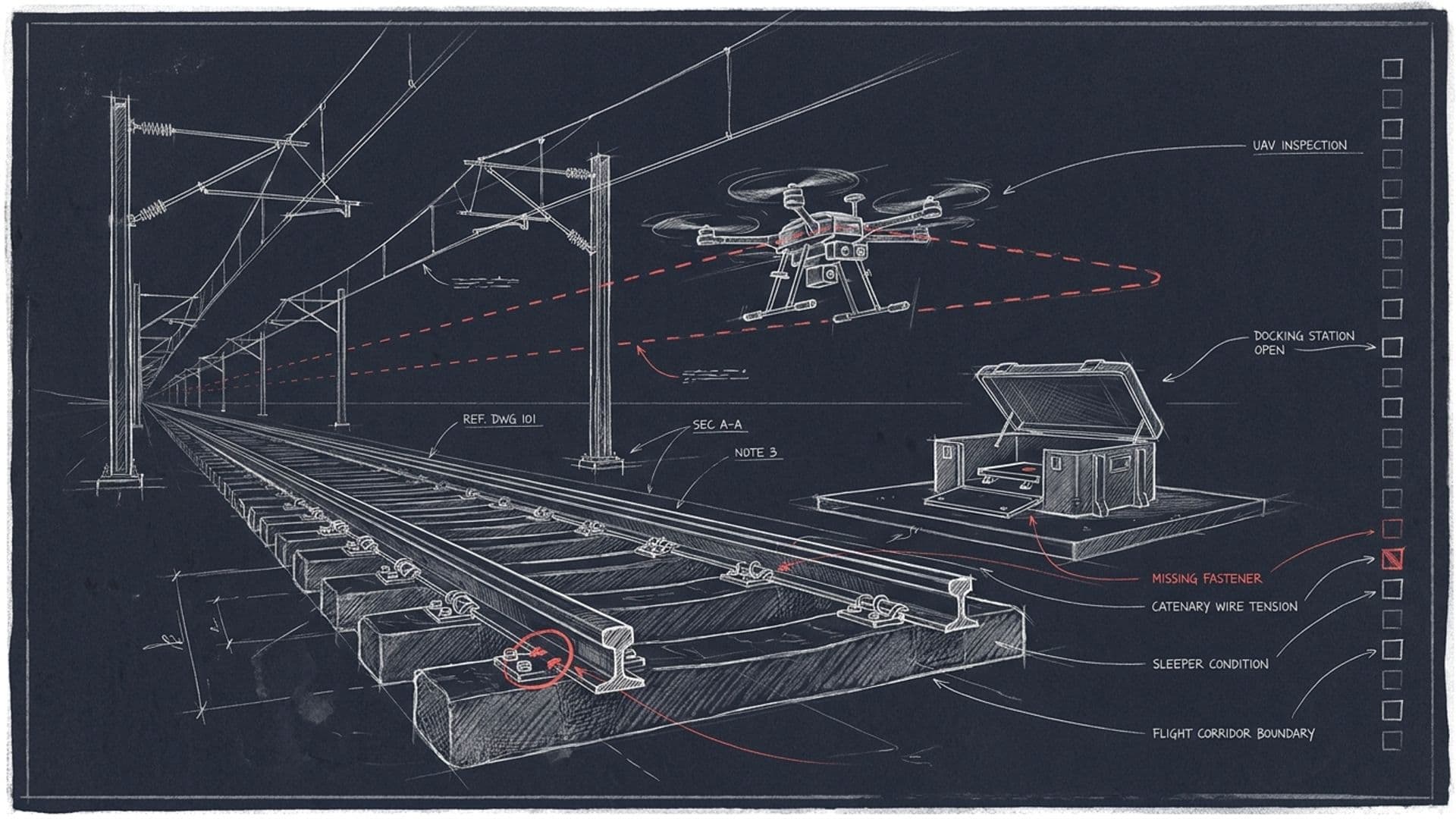
Overhead contact system | Contact wire, droppers, insulators, clamp hot spots, geometry | LiDAR, thermal, zoom RGB | Keep the agreed standoff from live wires |
Earthworks | Slope movement, erosion, rockfall risk | LiDAR, photogrammetry | Change detection across flights |
Drainage | Blocked culverts and ditches, standing water | RGB, thermal | Seasonal cadence |
Vegetation | Encroachment into the clearance envelope, fall-risk trees | LiDAR, multispectral | Feeds the vegetation contract |
Structures | Cracking, spalling and corrosion on bridges, viaducts, tunnel portals | Zoom RGB, close-range flight | Often VLOS work |
Boundary and security | Fence damage, trespass points, cable theft | RGB, thermal at night | ProRail lists copper-theft surveillance as a use |
LiDAR is doing more of the corridor work: Sweden's Trafikverket and NRC Group use drones to collect LiDAR data on the contact wire, ballast and vegetation without disturbing trains, and ProRail says LiDAR drones can take over mapping it used to do by helicopter.
Write the sensor specification per defect class, not per aircraft — the ground sampling distance to see a clip, the point density to model a contact wire, the thermal resolution to tell a warm clamp from a hot one — then check the aircraft delivers it at the height and speed your approval allows.
Operating models: crews, BVLOS corridors, docks
Model | How it works | Approval path | Best for | Watch out for |
|---|---|---|---|---|
Crew-deployed, VLOS | Pilot and observer on site, launching near the asset | Specific category (VLOS) or Part 107 | Structures, incidents, spot checks | Track access per shift; limited kilometres per day |
BVLOS corridor flights | Long-range aircraft flies the line, monitored remotely | SORA, STS-02 or PDRA-G03; Part 107 waiver | Network surveys, vegetation, earthworks | Approval effort, airspace, command-and-control link |
Docked drones (drone-in-a-box) | Docks along the line or on a road or rail vehicle; scheduled or triggered flights | Specific-category authorisation with remote operations | High-cadence monitoring of critical segments, night-time incident triage | Dock siting, power, communications, maintenance |
Docks are where Dronehub works. Our drone-in-a-box re-arms the aircraft with a two-minute robotic battery swap and is designed for 24/7 operation, with mission coverage of roughly 20 km per drone per flight, first-pass classification on onboard Nvidia compute, and reports reaching the operator within 15 minutes of landing through our in-house Sentinel AI; imagery stays on EU and US infrastructure. UAV Nomad, our mobile dock, swaps batteries on a vehicle moving at up to 30 km/h. Other dock makers differ — MicroAvia, for example, also swaps batteries and quotes one dock per 10 km of railway — so compare vendors on your own corridor. See our rail page and why operators move away from calendar inspection.
Operational safety near the line
- Magnetic and radio interference. ProRail warns that 1,500–25,000 V overhead lines can disturb drones' radio signals and electronics. The UK's Air Accidents Investigation Branch recorded a 2019 loss of control after take-off from a road bridge, where magnetic deviations of up to 140° were found above ducted high-voltage wires. Test compass behaviour at each launch site.
- Turbulence. ProRail notes that within 5 m of the track, turbulence can unbalance the drone and the pilot.
- Forced landings. Define who calls the signaller, who may go on the track and how the line is protected if the aircraft comes down foul of it.
- GNSS quality. Cuttings, tunnels and steel structures degrade positioning; locating findings to the sleeper may need RTK.
Data handling: privacy, sovereignty, the path to maintenance
Cameras pointed at a railway also see platforms, level crossings and gardens. EASA's guidance says a data protection impact assessment (GDPR Article 35) is required whenever processing is likely to result in a high risk to people's rights, should be done before the first flight, and should cover data minimisation. In practice: blur people and vehicles by default, keep raw footage only as long as maintenance needs it, and record who can see what.
Three further questions decide whether the programme is useful:
- Where does the data live? Hosting jurisdiction, access control and an audit trail matter, especially for operators that count as critical infrastructure.
- How do findings reach maintenance? Each finding needs a track position and an asset ID, and should land in the maintenance system as a work order, not a folder of images; see our note on edge and cloud inference.
- How good is the model on your network? Ask any vendor for precision and recall on held-out data from your own track, human review of flagged frames, and a retraining plan.
Who offers railway drone inspection
Many large railways fly their own drones: Network Rail publishes its programme, PKP PLK reported that its own staff flew drones over more than 3,200 km of line in 2020–21 to supervise investment works, and BNSF has flown BVLOS under FAA authority. For operators that buy rather than build, the table lists companies that describe railway drone products or services on their own websites. It is not a ranking.
Company | Type | What it says it does |
|---|---|---|
Altametris (France) | Services and software | SNCF Réseau subsidiary (2017) collecting rail data by drone without disrupting operations |
Drone-in-a-box | 24/7 autonomous railway monitoring, two-minute battery swap, one dock per 10 km | |
Dock software | Automated docks integrated with yard management, CMMS, dispatch and GIS systems | |
Nordic Unmanned (Norway) | Hybrid air-and-rail drone | Staaker BG-300 drives on the track, lubricates switches, covers 200+ km per mission on hydrogen |
Dronehub (US / Poland) | Drone-in-a-box and AI | Two-minute robotic battery swap, in-house Sentinel AI, EU and US data path — our own product |
Where to start
Pick one segment with a known defect history, define the defect classes you care about, fly it long enough to compare drone findings with your inspection records, then choose between crews, corridor flights and docks. Approvals, the track-access agreement and the data path take longer than the flying — start them first. For the architecture behind an autonomous programme, read autonomous AI rail inspection; to scope a corridor with us, get in touch.
FAQ
- Can you fly a drone near a railway?
- Only within the right flight category and the rail infrastructure manager's rules. In the EU, inspection flights over or close to the track almost always fall into the 'specific' category, and national rules often add buffers — the Netherlands, for example, prohibits open-category flights over the track and requires 25 m of separation for drones under 4 kg and 150 m for drones of 4 to 25 kg. In the US, Part 107 applies, flights beyond visual line of sight need a waiver, and anyone working on or near the track falls under the railroad's roadway-worker-protection rules. In every case, agree the flight with the infrastructure manager first.
- What are the requirements for railway drone inspection in the EU?
- Under Regulation (EU) 2019/947, corridor inspection usually needs the 'specific' category: an operational authorisation from the national aviation authority based on a SORA risk assessment (now SORA 2.5), a declaration under standard scenario STS-02, or an authorisation under EASA's PDRA-G03 for linear inspections. The aviation approval does not grant track access — the infrastructure manager's rules on access, flight notification and overhead-line safety apply on top — and GDPR applies to any personal data the cameras capture, which often requires a data protection impact assessment before flying.
- Do you need a BVLOS waiver to inspect railway track with a drone in the US?
- Yes, as of September 2026. 14 CFR 107.31 requires the remote pilot to see the aircraft throughout the flight, and beyond-visual-line-of-sight work needs a waiver under 107.205 or an exemption. The FAA's proposed Part 108 would create a standing BVLOS framework and would treat airspace within 50 feet of railroad tracks as a shielded area when the railroad gives permission, but as of late September 2026 no final rule had been published in the Federal Register.
- What sensors are used for drone catenary inspection?
- Usually three in combination: LiDAR for overhead-line geometry and vegetation clearance, thermal imaging for hot spots at clamps, connections and insulators, and high-resolution zoom cameras for droppers, insulators and fittings. Sweden's Trafikverket has worked with NRC Group on drones that collect LiDAR data on the contact wire, ballast and vegetation without disturbing train traffic. Plan a standoff from live lines: overhead-line currents can distort drone compasses, and the UK AAIB has recorded a 2019 loss of control near ducted overhead wires.
- Can drone inspections replace FRA-required track inspections?
- Not on their own. 49 CFR 213.233 requires visual track inspections by a qualified person, made on foot or from a vehicle on a fixed schedule — weekly on Class 1–3 main track and sidings (twice weekly where they carry passenger trains or more than 10 million gross tons a year) and twice weekly on Class 4 and 5 track — and allows other inspection devices only to supplement them. Drones add value around that requirement: structures, drainage, vegetation, earthworks, night-time incident triage and trend data between mandated inspections.
- How are drones used for railway track and catenary inspection, and which companies offer it?
- Railways fly drones to inspect track and structures, overhead lines, vegetation, drainage and earthworks, and to respond to incidents. Many run in-house programmes — Network Rail, PKP PLK and BNSF among them — while others buy services or equipment: Altametris (an SNCF Réseau subsidiary) for rail drone data, dock and software vendors such as MicroAvia and FlytBase, Nordic Unmanned's hybrid air-and-rail drone, and drone-in-a-box infrastructure such as Dronehub's.